Home
Beverley Road HEY LEP Cycle Route Improvement Scheme
Beverley Road HEY LEP Cycle Route Improvement Scheme

Funding has been awarded to the City Council from the Hull and East Yorkshire Local Enterprise Partnership (HEY LEP), to address gaps in the cycle network across the city of Hull and improve links with adjoining areas of the East Riding of Yorkshire. This offers a further opportunity to improve and extend cycling facilities along Beverley Road, creating a continuous and more convenient route.
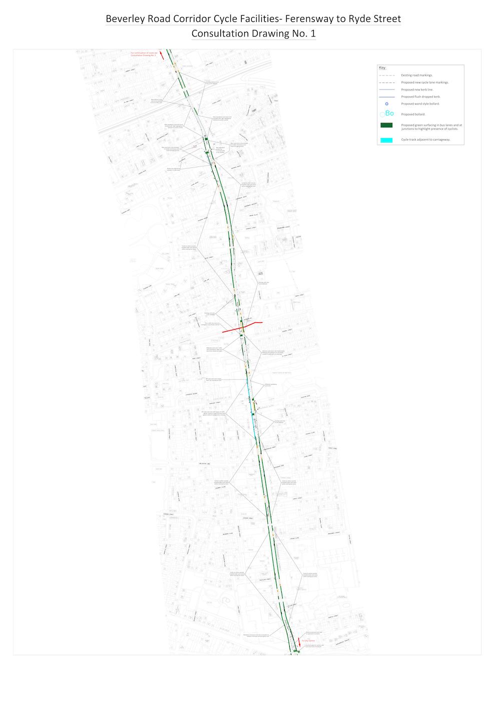
The proposed route of 5.4km will run the entire length of Beverley Road, from Ferensway to the city boundary near Dunswell Roundabout. It is a fast, direct route that is useful for commuting by cycle, but currently has some gaps in cycle provision and is only really suitable for more experienced cyclists. The aim of the scheme is to make it safer for all cyclists and to encourage new or less experienced cyclists to give it a try. Improvements to facilities for pedestrians are also proposed.
The proposals include:
• New off-road cycle tracks on the section north of Greenwood Avenue all the way to the city boundary;
• Provision of new and improved signalled pedestrian crossing facilities at Station Drive, Queens Road and Inglemire Lane;
• Widening of existing cycle lanes, providing improvements to the road surface and adding green ‘branding’ to highlight the presence of cyclists to motor traffic;
• Providing sections of ‘light segregation’, featuring flexible style bollards to give physical separation between the cycle lanes and passing traffic;
• Low-level signals and ‘early-start’ facilities for cyclists at key junctions along the route;
• Links to the recently improved cycling infrastructure on Freetown Way, Spring Bank, and the new Hull City Centre to Cottingham HEY LEP route via Station Drive;
• Comprehensive route signing and additional on-road markings to assist correct positioning for cyclists where the route utilises bus lanes.
Traffic modelling is currently being used to evaluate the impact on traffic of the proposed changes to the highway layout on the main junctions along the route, where works are being proposed. The traffic modelling will help to inform the operational impact of the final designs of the scheme to assist in minimising congestion.
We would like to hear your views on proposals for this route - please look at the plans below (under 'additional materials') and complete the survey at the bottom of the page.
To ensure any amendments can be incorporated into the proposals, this consultation will end on Sunday 20th June 2021.
Additional materials


This engagement phase has finished

...