Home
Anlaby Road Active Travel Improvement Scheme
Anlaby Road Active Travel Improvement Scheme

Proposed upgrades to cycling infrastructure along Anlaby Road, between the city boundary and Ferensway
The route along Anlaby Road, all the way from the city boundary to Ferensway, is a popular route for cyclists, forming the quickest and most direct link for many journeys by bike. However, it is a busy road and although there are some cycle and bus lanes in place at present which help, it can be daunting, particularly for new or inexperienced cyclists.
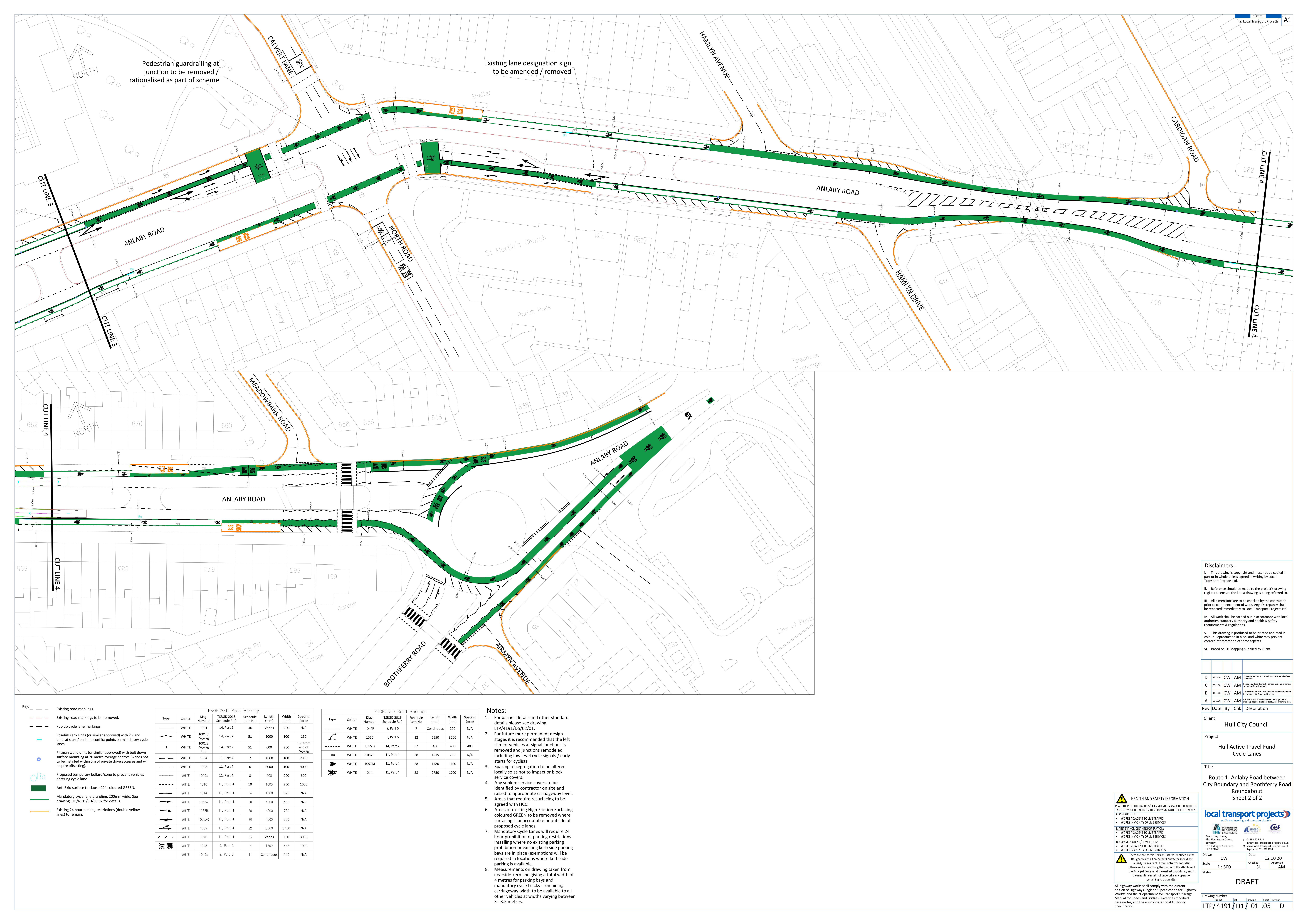
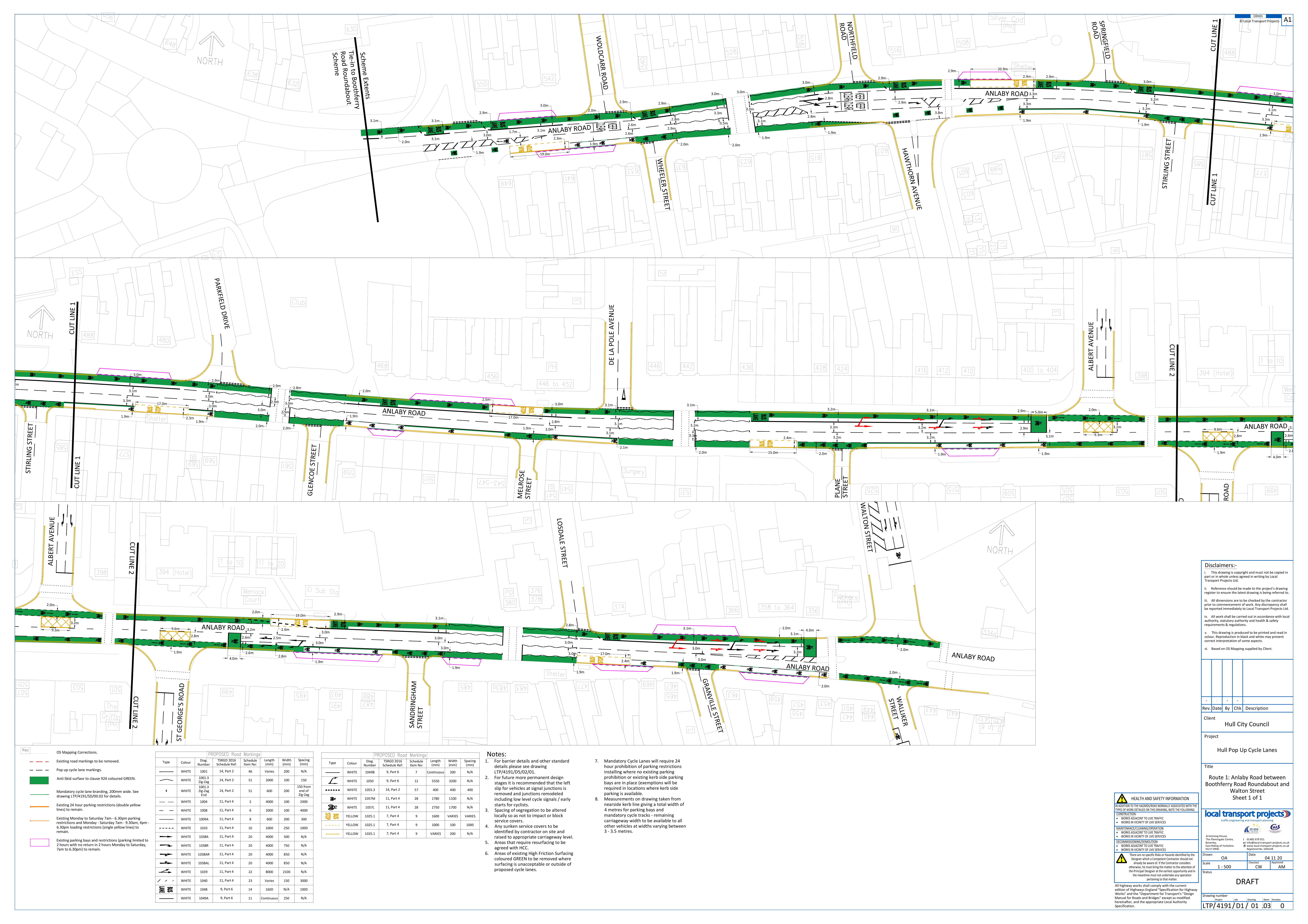
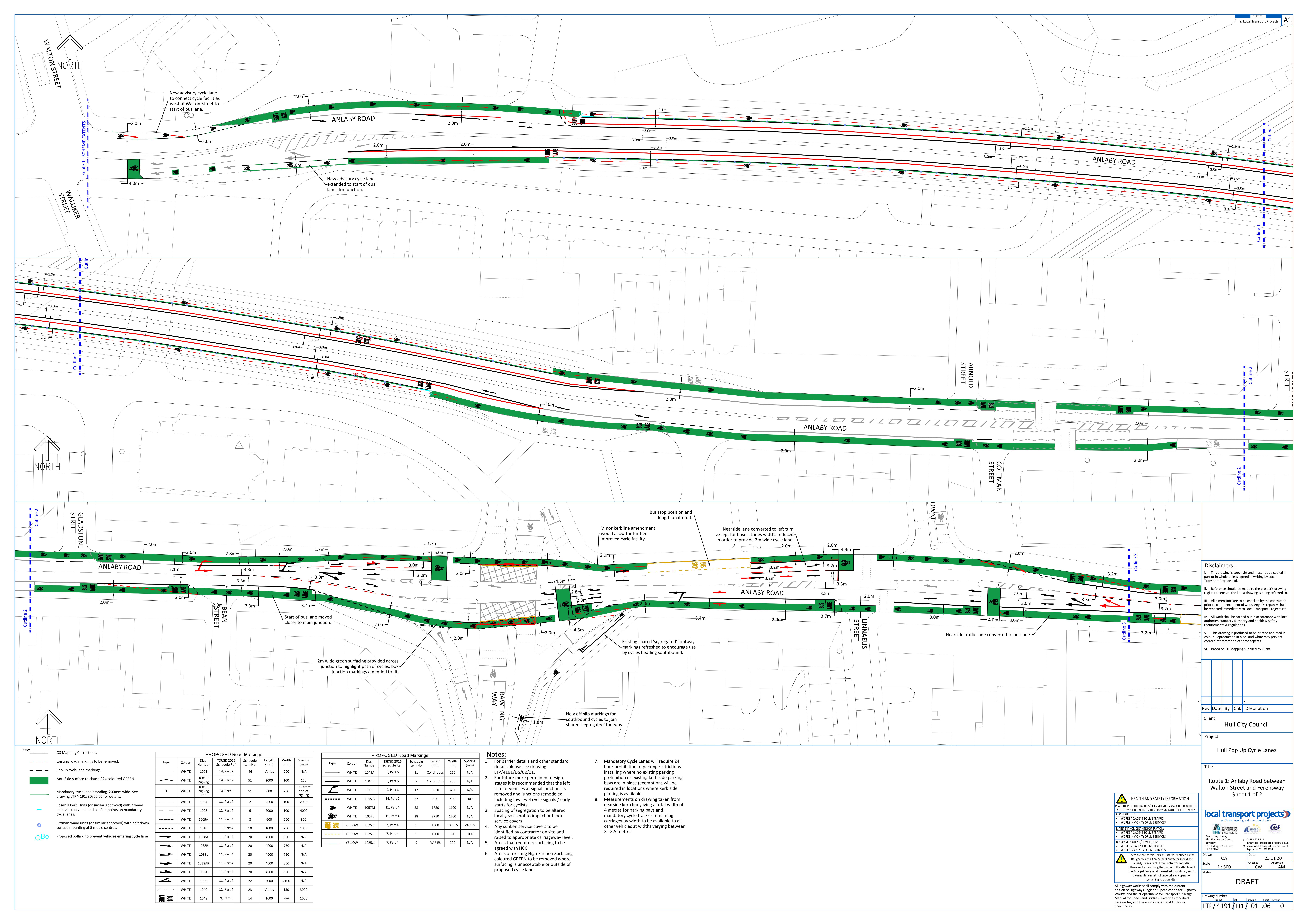
Funding has been awarded to the City Council from the Department for Transport’s Active Travel Fund, to implement upgrades to cycle facilities on many of the main roads in the city, offering an opportunity to upgrade the facilities that are already in place, to make them safer, better joined up and more convenient to cycle along. Proposed changes include:
• Making existing cycle lanes wider
• Converting some of the existing advisory cycle lanes to mandatory
• Joining up sections of existing bus/cycle lanes with new sections of cycle lane
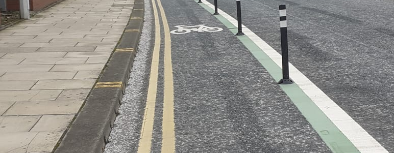
• Providing flexible bollards in places to give some physical separation between the cycle lanes and passing traffic
• Making improvements at junctions to define the areas where cyclists ride and make them more visible to drivers
• A new section of cycle/bus lane heading out of the city, between Pease Street and Park Street
• “Branding” the cycle lanes with green surfacing material to highlight the presence of cyclists to drivers of other vehicles, and to provide a visible indication that there is a continuous cycle route in place along the full route.
Existing car parking will be unaffected. Cyclists will be able to use the bus lanes. Green coloured surfacing and bike symbols will be installed on the road to highlight the position cyclists should adopt within the bus lanes, these do not need to be followed rigorously, especially if you have to overtake a bus or parked vehicle.
The work will increase capacity and safety for cyclists and enable more consistent journey times for buses.
It is hoped that the works will encourage more people to cycle in the short term, providing a platform for more extensive works such as new kerb segregated cycle tracks and traffic lights for cyclists, in the future. 12 hour surveys conducted in June 2020, at the High Level Rail Line bridges over Boothferry Road and Anlaby Road recorded nearly 2300 two way cycle journeys.
To ensure any amendments can be incorporated into the proposed works, this consultation will end on Sunday 17th January 2021.
The bus lane operating times were amended to operate from 0700 - 1830 (Monday to Saturday) as part of an experimental traffic regulation order (ETRO).
File Ref 39800/1411 –The Kingston upon Hull (Bus Lanes) (Change of Operational Times) (Experimental) Order 2020 Experimental Bus Lane – Order made on 3rd July 2020
Any objection to this ETRO needs to be in writing by the 3rd January 2021, quoting the reference number, (Ref: JGO/39800/1411) stating the grounds for your objection to Legal Services to Legal Services, The Guildhall, Alfred Gelder Street, Kingston upon Hull. HU1 2AA.

Additional materials


This engagement phase has finished

...
